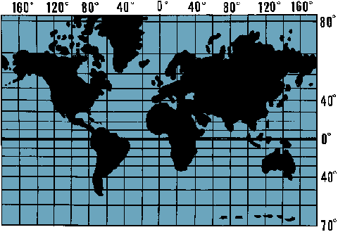
: a conformal map projection of which the meridians are usually drawn parallel to each other and the parallels of latitude are straight lines whose distance from each other increases with their distance from the equator
Illustration of Mercator projection
Examples of Mercator projection in a Sentence
Recent Examples on the Web
Examples are automatically compiled from online sources to
show current usage.Read More
Opinions expressed in the examples do not represent those of Merriam-Webster or its editors.
Send us feedback.
Ferencevych was referring to the Mercator projection, created in 1569 to aid maritime navigation.—
James Cirrone,
FOXNews.com,
5 Sep. 2026 The Mercator projection was developed primarily for navigation.—
Jewel Bright,
NPR,
4 Sep. 2026 The Mercator projection shows Greenland and Africa as appearing to be about the same size whereas in the Equal Earth projection that shows continents in their true proportions, Africa is 14 times larger than Greenland.—ABC News,
4 Sep. 2026 Digital map platforms such as Google Maps also currently use a version of the Mercator projection.—
Amarachi Orie,
CNN Money,
4 Sep. 2026 See All Example Sentences for Mercator projection


 Copy Citation


